


African Union Calls for Accurate Maps to Reflect Continent's Real Size


Addis Ababa, Ethiopia - In a landmark move, the African Union (AU) has urged the international community to adopt a new world map that accurately reflects the true size of the African continent. The call to action was made during a high-level meeting at the AU headquarters, where leaders and experts gathered to discuss the importance of cartographic representation and its impact on global perceptions.
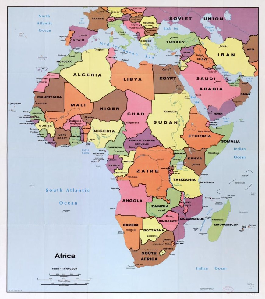
The current standard world map, known as the Mercator projection, has been widely criticized for distorting the size and shape of countries near the equator, particularly in Africa. This has led to a persistent misperception of the continent's geographical scale and significance. The Mercator projection, developed in the 16th century by Flemish cartographer Gerardus Mercator, was originally designed for navigation purposes but has since been widely adopted for general use despite its limitations.
The AU is advocating for the adoption of alternative map projections, such as the Gall-Peters projection or the AuthaGraph world map, which more accurately represent the relative sizes of countries and continents. These maps provide a more proportional view of the world, showcasing Africa's true size and significance.
According to Dr. Amina Mohammed, AU Commissioner for Economic Development, "The current map projection has contributed to the marginalization of Africa and perpetuated stereotypes about the continent's size and importance. It's time for us to reclaim our narrative and showcase our true potential."
The AU's initiative has garnered support from various quarters, including the African diaspora, cartographers, and geographers. Many argue that an accurate map would not only enhance Africa's global image but also promote a more nuanced understanding of the continent's diversity, cultural richness, and economic potential.
The adoption of a new world map could have far-reaching implications, from influencing educational materials and media representation to informing policy decisions and international collaborations. As the world becomes increasingly interconnected, the need for accurate and inclusive cartographic representation has never been more pressing.
The international community has begun to take notice of the AU's initiative, with many experts and organizations weighing in on the importance of accurate cartographic representation.
The African Union's initiative is expected to spark a global conversation about the importance of cartographic representation and its impact on our understanding of the world.
Source – Lead News Online